Chapter5
Sensor-depentdent Preprocessing/感測器相關前處理功能
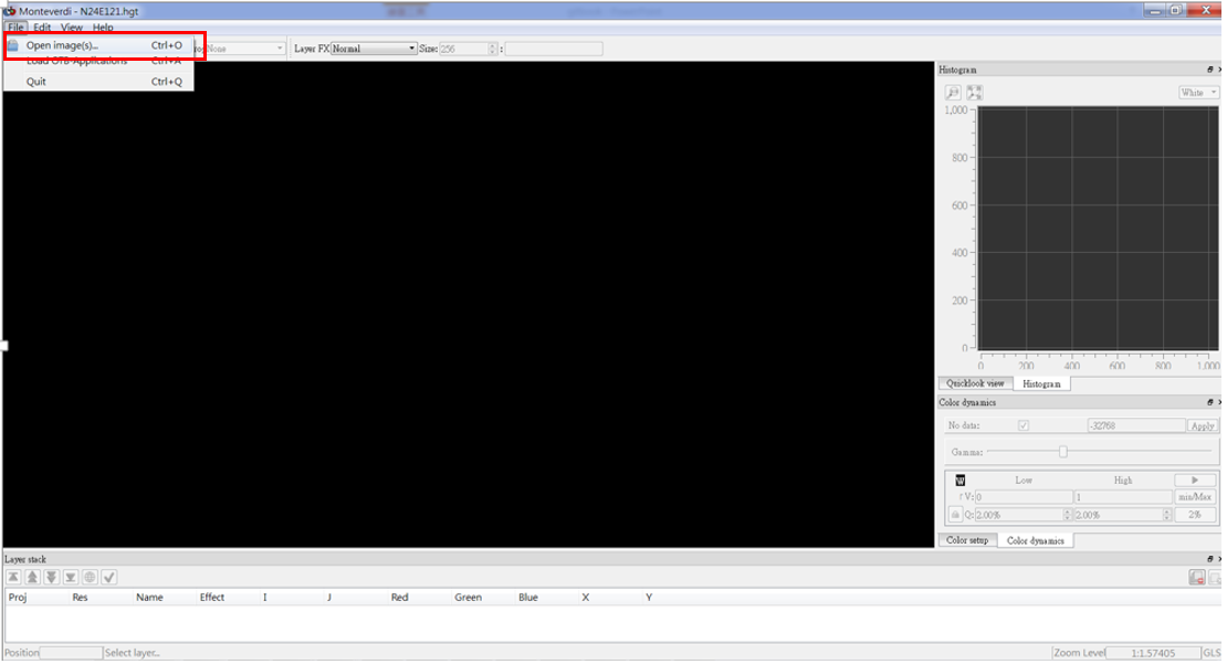
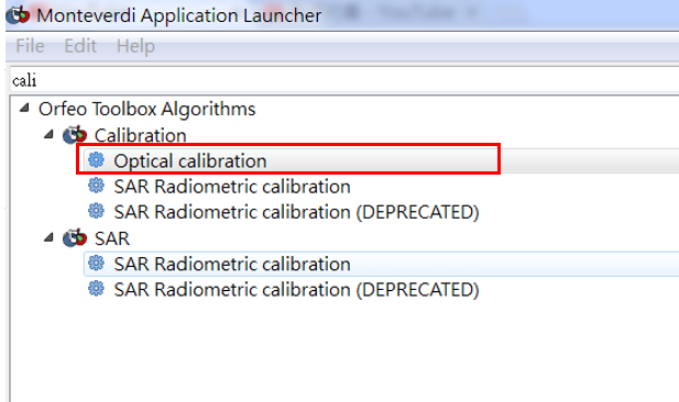
5-1. Calibration: Optical Calibration
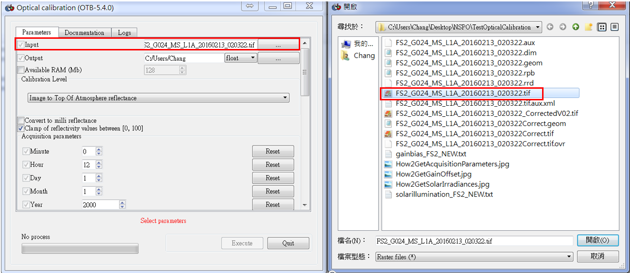
(1) 用Mapla.bat介面點選「Optical calibration」,目的做光學率定,從感測器DN值推算地表真正輻射值。
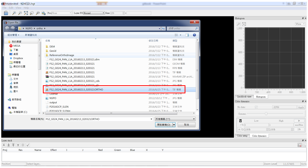
(2) Input image (.tif)
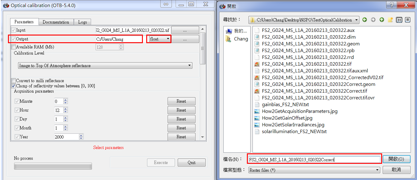
(3) Output image
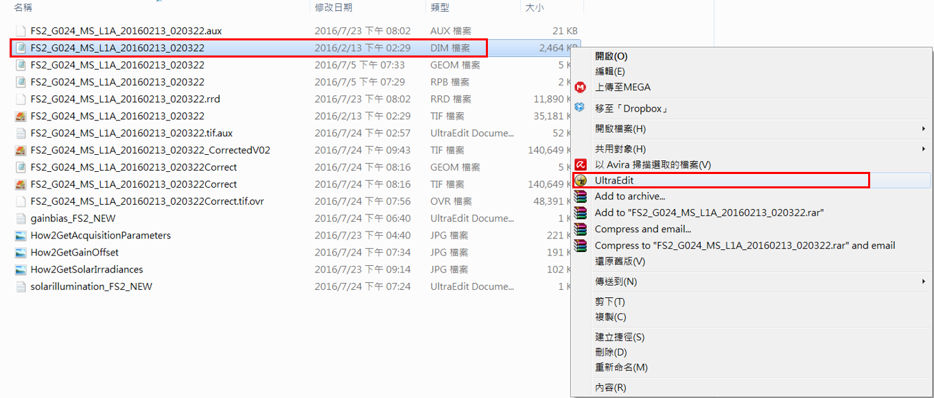
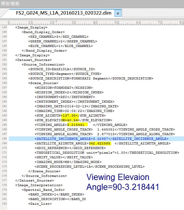
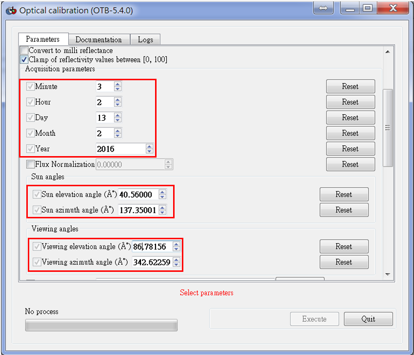
(4) 開啟dim檔檢視影像參數(建議以UltraEdit開啟),包含衛星、太陽角度參數,以及拍攝時間參數可計算地球與太陽實際距離。
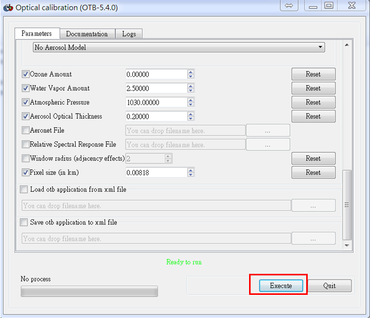
(5) 參數設定
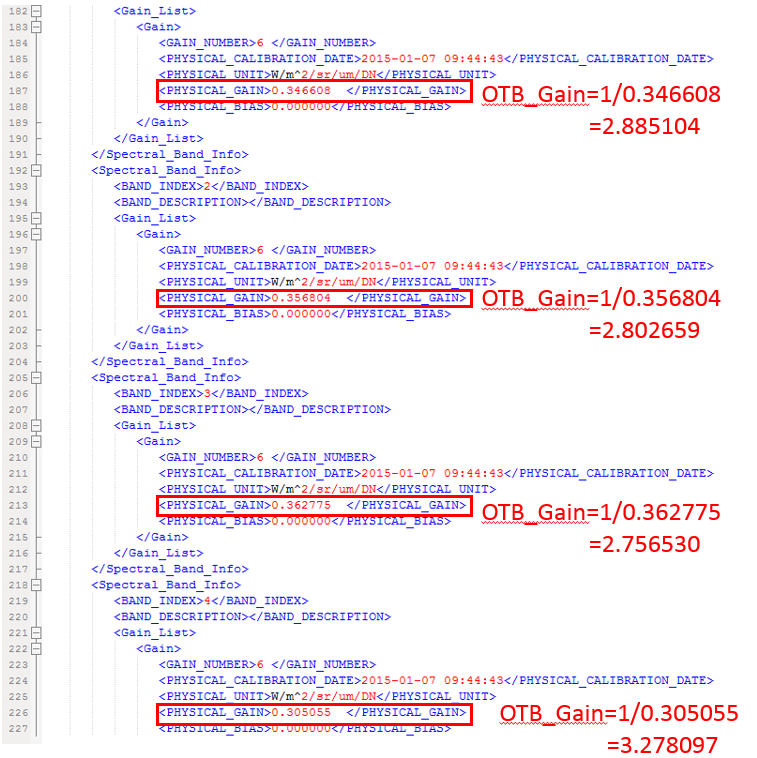
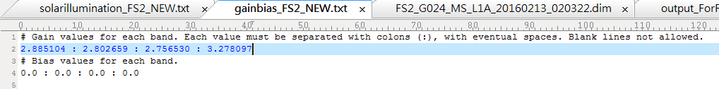
(6) Gains Biases
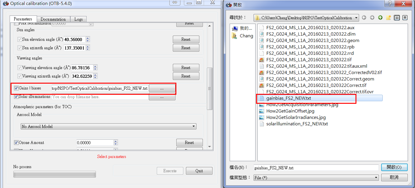
開啟dim檔有Gains Biases參數,注意需要換成倒數,並將參數匯成txt檔。
(7) Solar illuminations
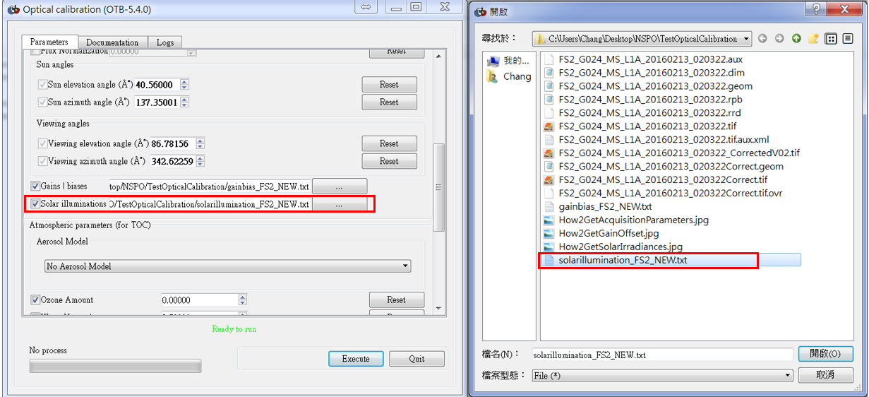
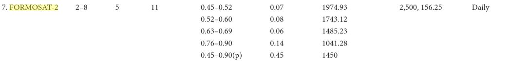
Solar illuminations的來源可到下列網站找尋,並將參數匯成txt檔。
https://books.google.com.tw/books?id=Sne9CgAAQBAJ&pg=PA238&lpg=PA238&dq=formosat-2+irradiance&source=bl&ots=ZKG7Iiwb6z&sig=M9W-AKUg2QL_TvGMEDBpeagh7Jk&hl=zh-TW&sa=X&ved=0ahUKEwif8ZOei5_OAhWItI8KHXmsCoQ4ChDoAQgbMAA#v=onepage&q=formosat-2%20irradiance&f=false

(8) 再按Execute,便可完成影像率定。
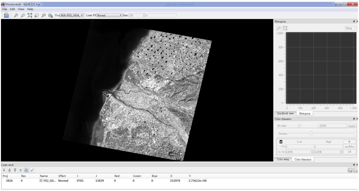
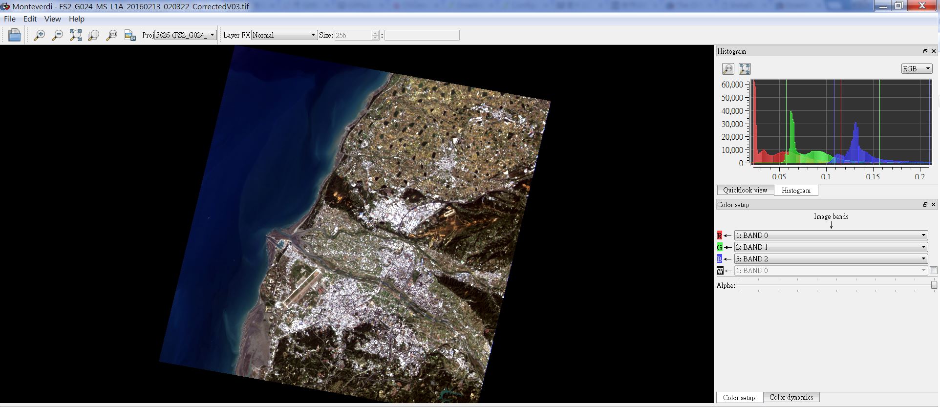
(9) 用Monteverdi.bat開啟calibration image
5-2. Geometry: Orthorectification and map projections
1. Data Source:
(1) Formosat-2原始影像
太空中心衛星資料庫快速查詢與即時服務系統(https://esoknspodb.nchc.org.tw)
(2) Formosat-2參考正射影像
太空中心衛星資料庫快速查詢與即時服務系統(https://esoknspodb.nchc.org.tw)
台灣地區的拼接正射影像,建議進入太空衛星資料庫
(http://esoknspodb.nchc.org.tw/nspo_esok/index.php)
如果沒有帳號密碼的話需要先申請
a.進入"衛星資料查詢"→僅將福衛二號選項勾選→按放大鏡圖示進入查詢
b.右側選單的產品類型只將融合(i)勾選→按下最底下的篩選
c.出現2012-2007年間的2m解析度融合正射產品
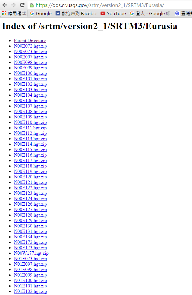
(3) DEM: SRTM 下載
方法1.(建議使用此方法)
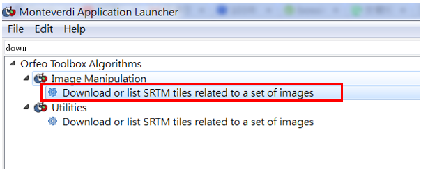
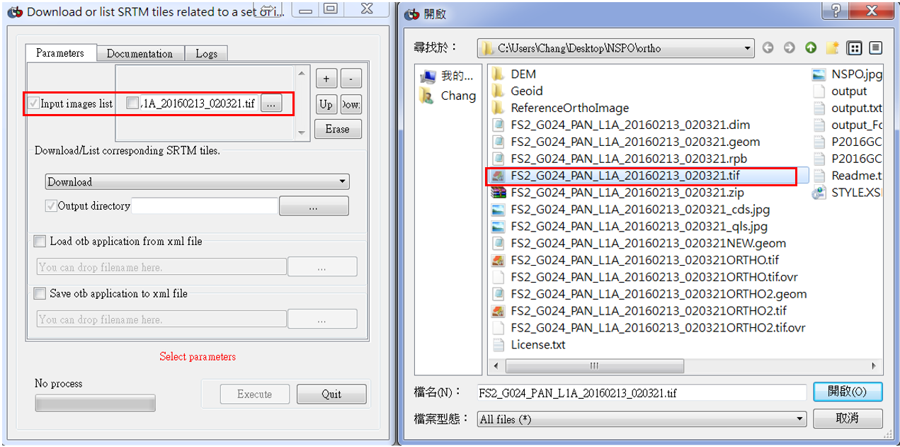
a. 用Mapla.bat介面點選”Download or list SRTM tiles to a set of images”,可直接下載影像所在區域的DEM。
b. Input image (.tif)
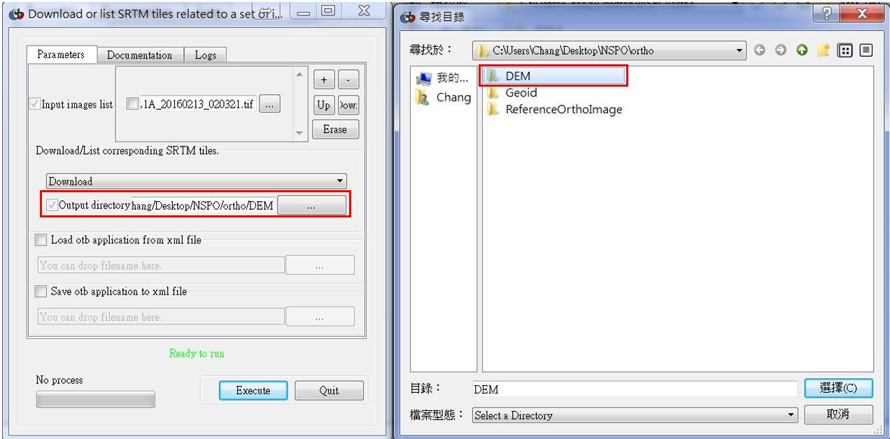
c. Output directory,再按Execute便可完成DEM下載。
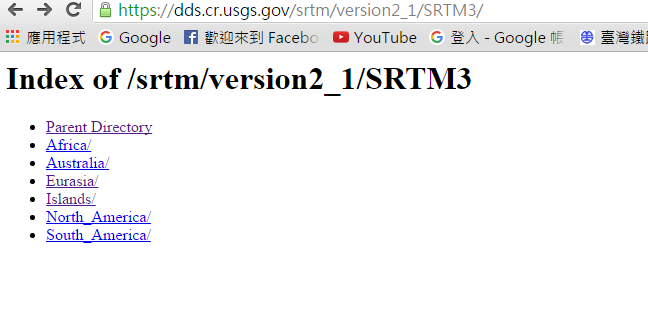
方法2. https://dds.cr.usgs.gov/srtm/version2_1/SRTM3/ 選擇區域,再選擇經緯度下載影像所在區域的DEM。
(4) 控制點來源:國土測繪中心的通用版電子地圖(用IE流覽器開啟http://emap.nlsc.gov.tw/gis103/)
2.影像正射化
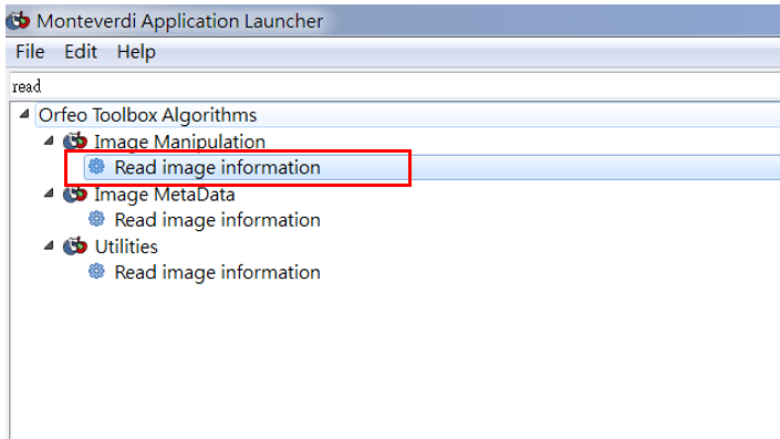
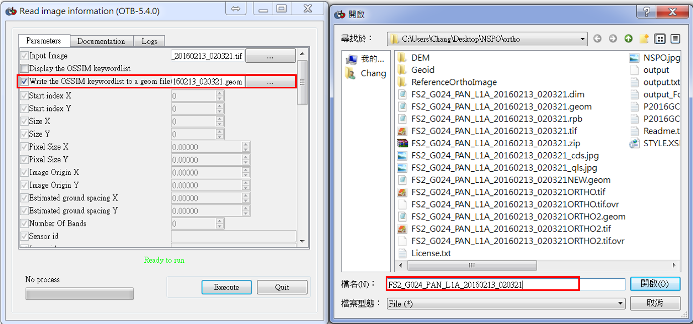
(1) 用Mapla.bat介面點選”Read image information”,目的是輸入原始影像(tif檔),輸出geom檔。
(2) 輸入完後出現以下畫視窗。
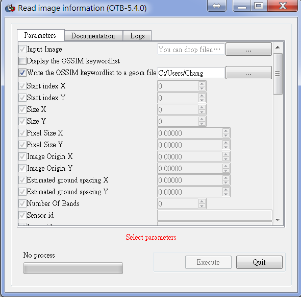
(3) Input image file Chap5-1輻射改正後影像(tif檔)。
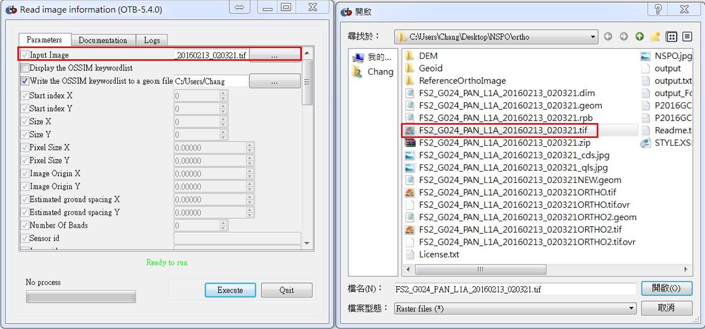
(4) Output geom檔,再按Execute執行。
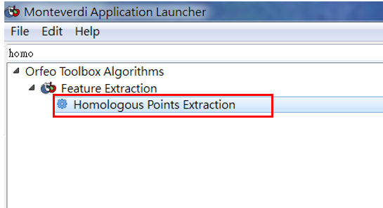
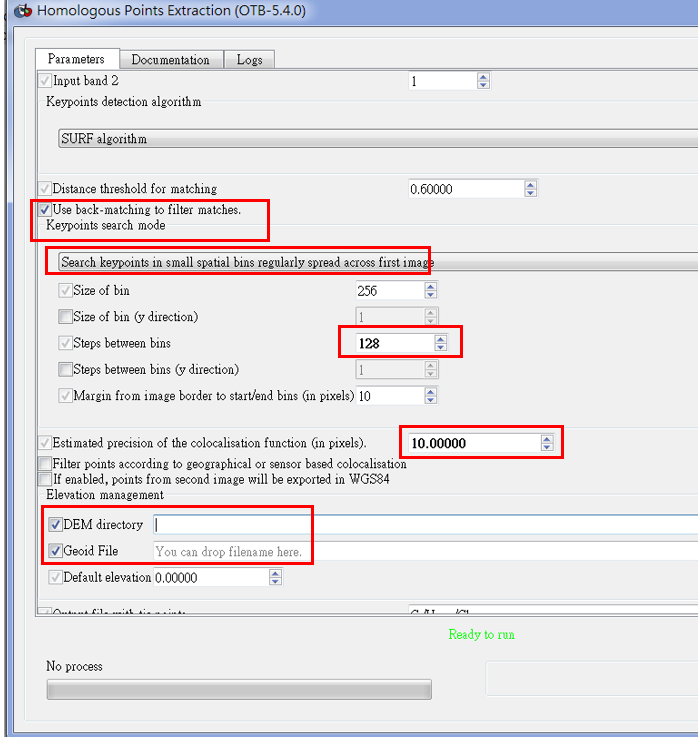
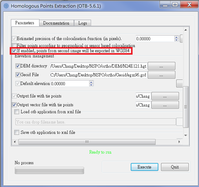
(5) 用Mapla.bat介面點選”Homologous Points Extraction”,為改正影像的geom檔,利用SIFT或SURF方法找匹配點。
(6) Input image file 1。
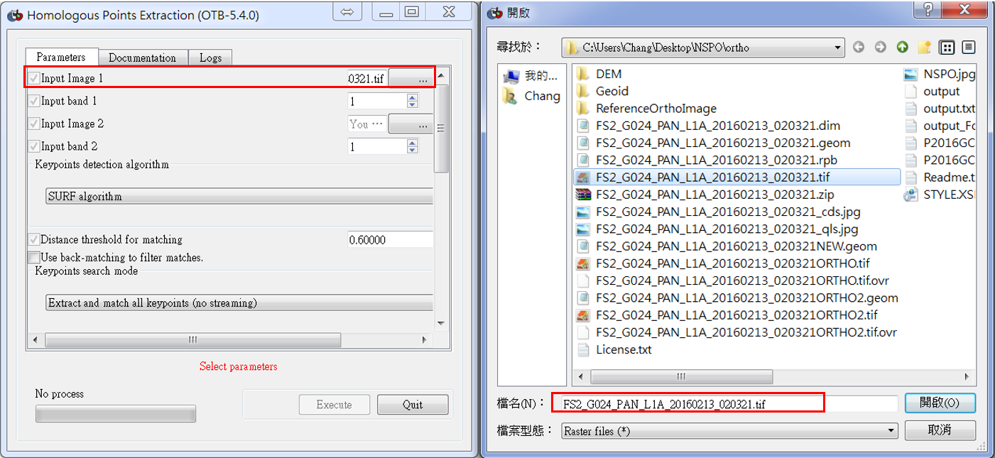
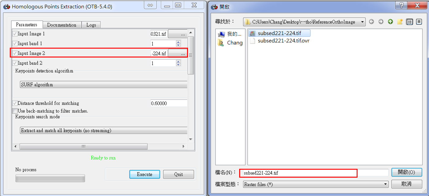
(7) Input image file 2 (reference image)。
(8) 設定參數如下圖。
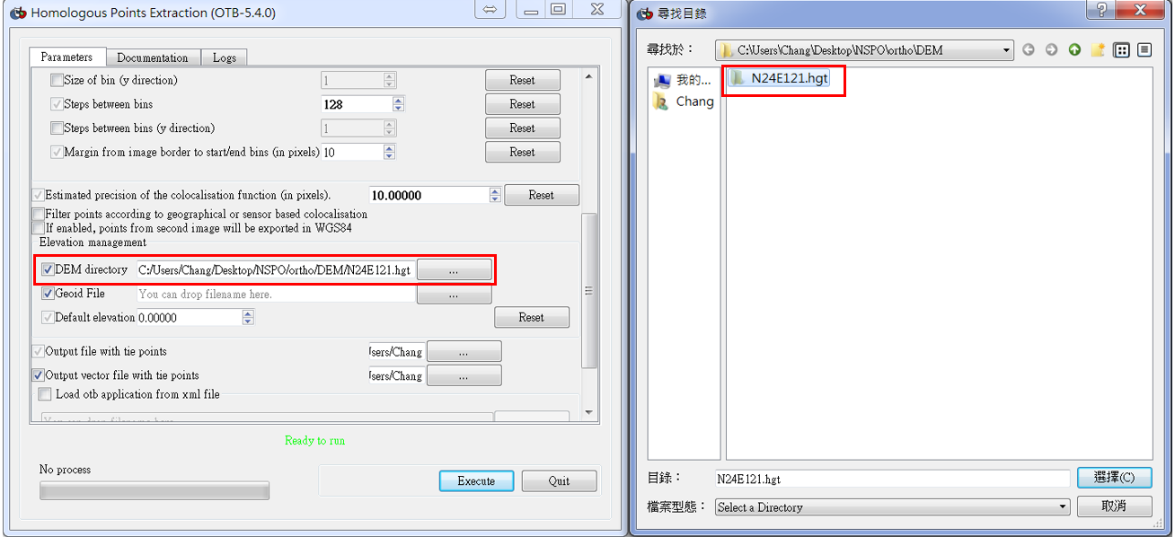
(9) Input DEM。
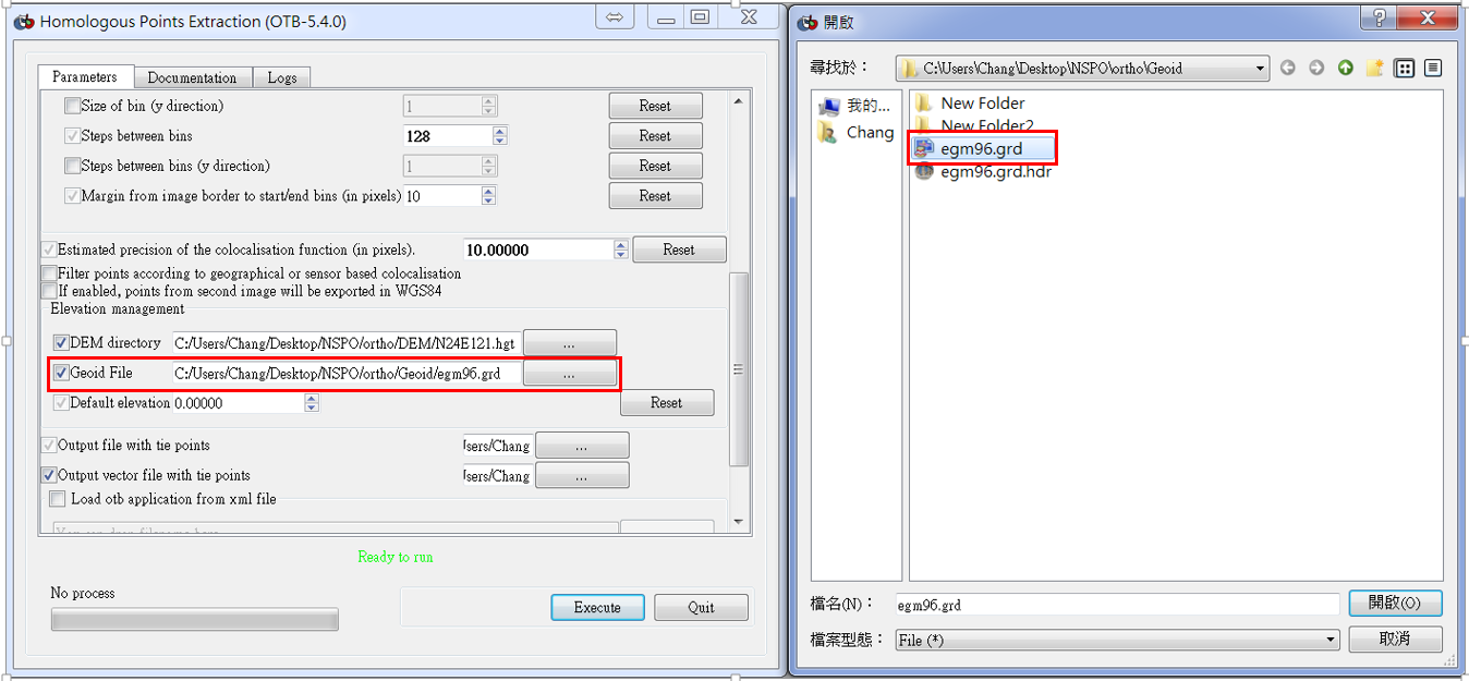
(10) Input Geoid,使用geoid model :EGM96 download。
(http://hg.orfeo-toolbox.org/OTBData/raw-file/404aa6e4b3e0/Input/DEM/egm96.grd)
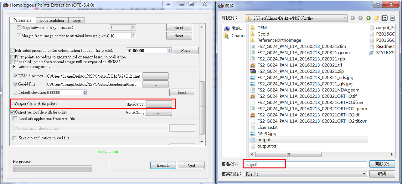
(11) Output file,建立一檔名。
(12) 勾選紅色框欄處,再按Execute,產生經緯度坐標系統。
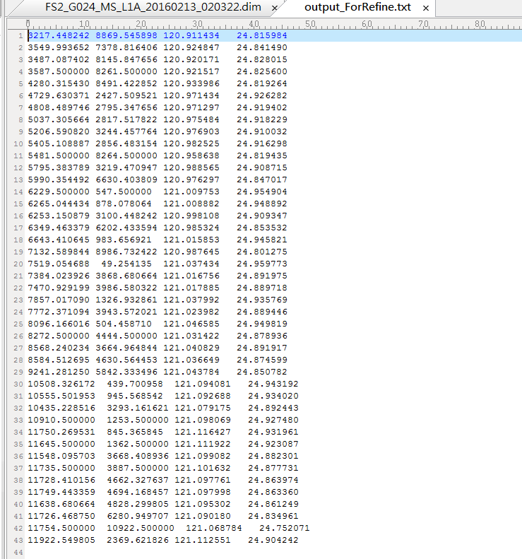
(13) Output.txt檔。
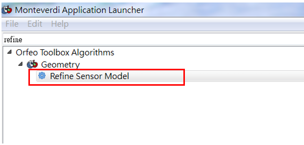
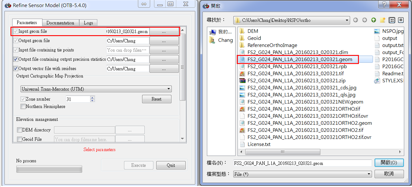
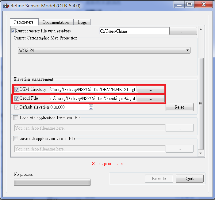
(14) 用Mapla.bat介面點選”Refine Sensor Model”,目地用前步驟產生的匹配點的經緯度坐標來更新geom檔。
(15) 輸入完後出現以下畫視窗
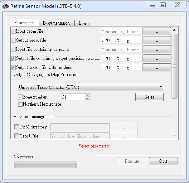
(16) Input geom file (.geom)。
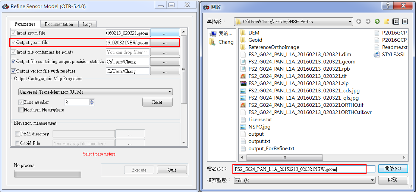
(17) Output geom file (.geom)。
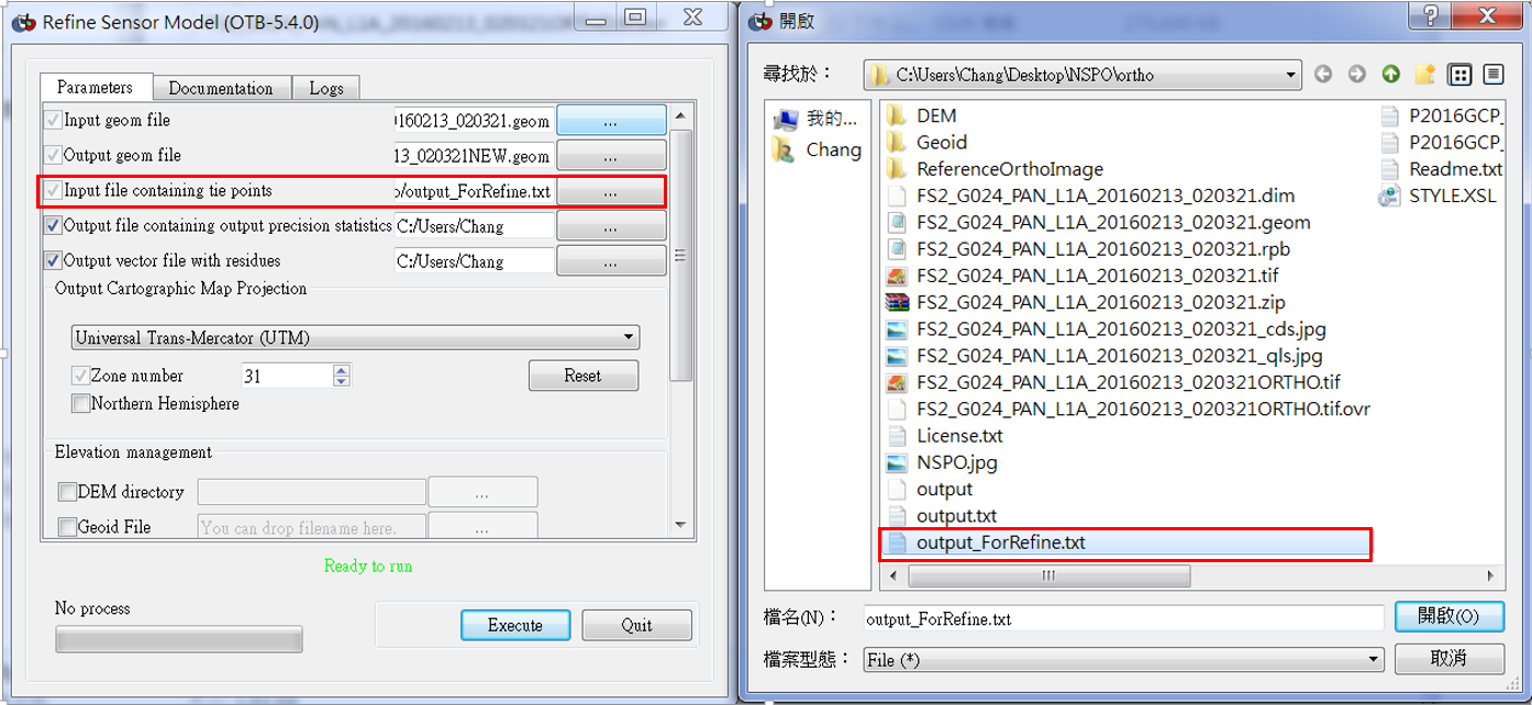
(18) Iutput file containing tie points (output_ForRefine),輸入匹配點的經緯度坐標。
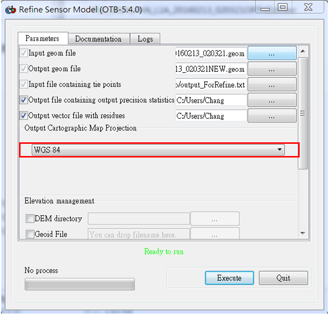
(19) 選擇投影坐標系統WGS84。
(20) DEM directory、Geoid File步驟同(9)(10),再按Execute。
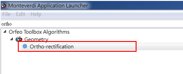
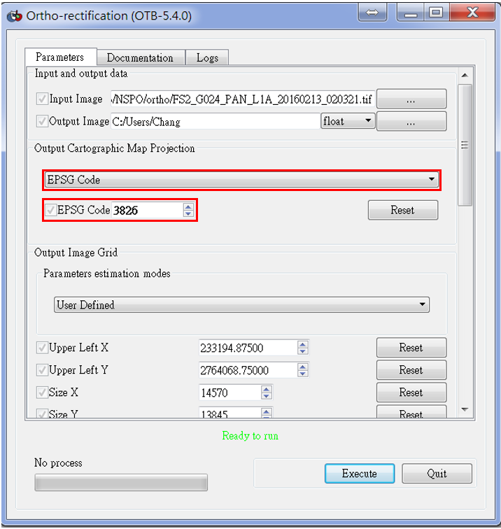
(21)用Mapla.bat介面點選” Ortho-rectification”,目的做正射改正。
(22) Input Image (.tif)。
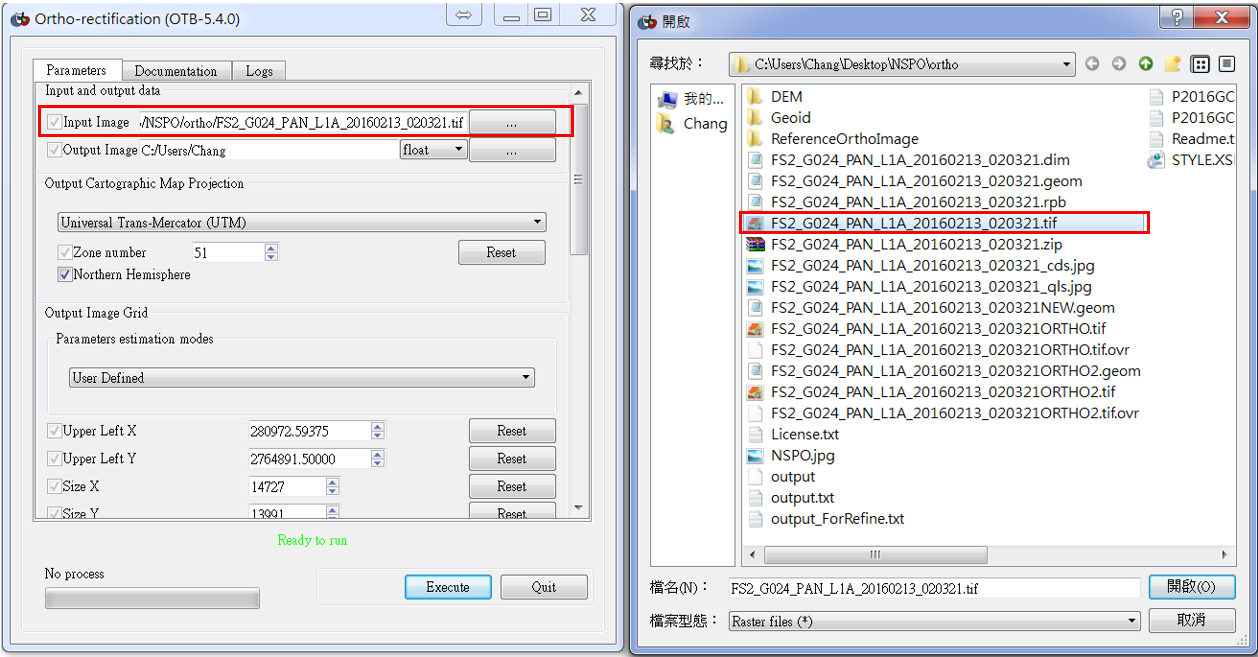
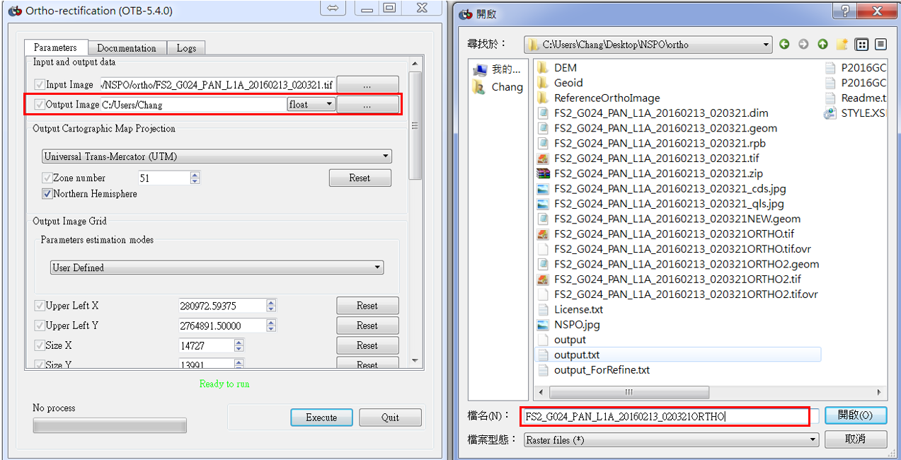
(23) Output Image(輸入檔名.tif) 。
(24) 投影坐標系統EPSG code,EPSG code:3826。
各影像有所不同,此影像以台灣為主。
(25) DEM directory、Geoid File步驟同(9)(10),再按Execute。
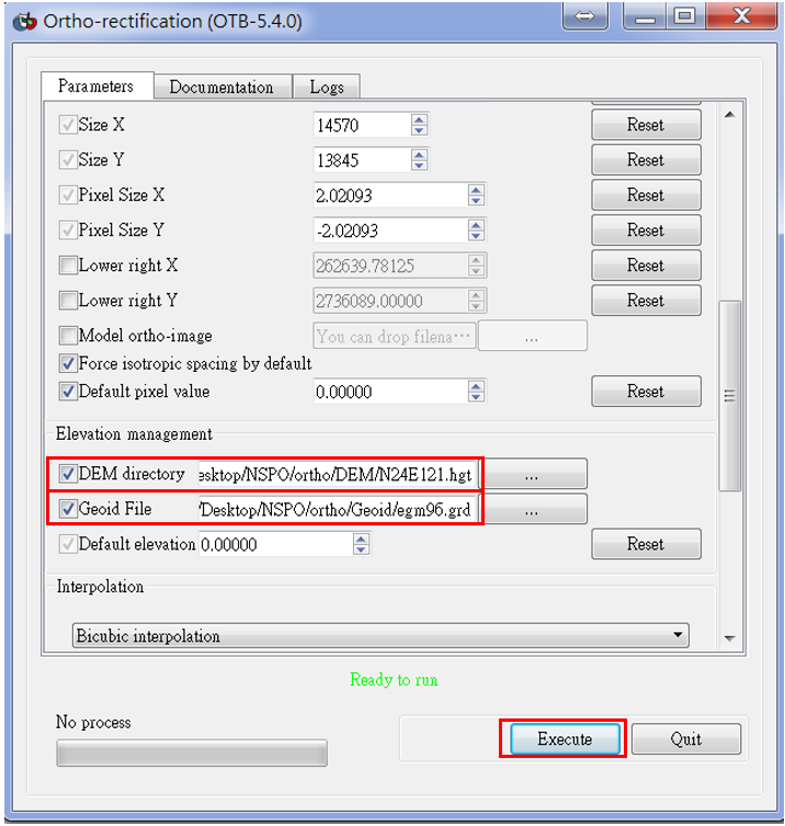
(26) 成功產生全色態正射影像(.tif),再以Monteverdi開啟影像 + Ref_Ortho。